
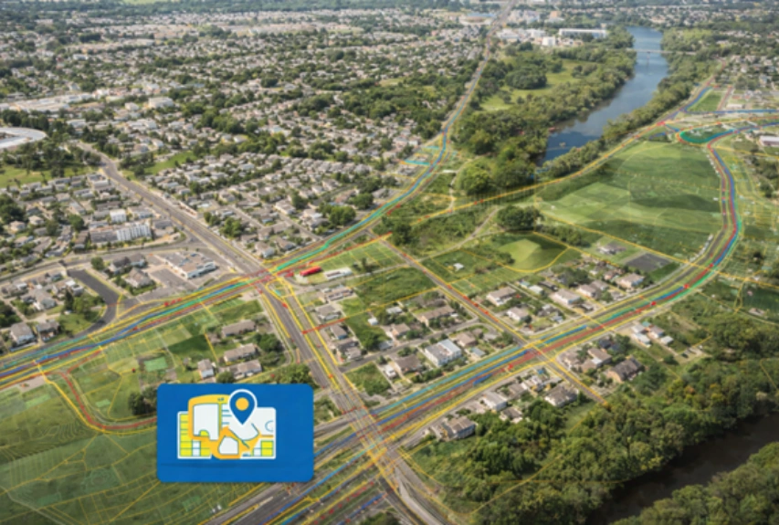
Electric and Gas Utilities
Maps utility assets with precise accuracy.
SCADD is the preferred mapping service provider for the world's main utility companies. SCADD ensures business continuity and relevance by providing GIS, remote sensing, and computer-aided design and drafting solutions to major electric and gas utilities throughout the world. SCADD specialises in reliable and efficient GIS platforms such as ArcFM, ArcFM UT, GE Smallworld, Ericsson Network Engineer, 3-GIS, AutoCAD, MicroStation, and other industry-standard tools for providing complete GIS Utility Mapping Services.
How Do We Work For Electric Utilities?
01
Design area boundary
02
Address list prepare
03
Pole identify
04
Underground area verification
05
Handhole and PED position
06
LCP and OLT area verify
07
Pole loading capacity Check
08
Mid span verify
09
Packaging and Pre-Permit work

Electric Utilities
Pole Cable Replacement & Rearrangement
SCADD is a top provider of pole loading analysis and make-ready engineering services to the global electric utility sector.
Integrating the data obtained from the customer's field crew, the SCADD technical team may give detailed pole-level analytics, including the following:
Pole replacement and structural mitigation design
Make-Ready Engineering
Cable-level design updates to address loading, clearance and configuration changes
How Do We Work For Gas Utilities?
Our team oversees the entire process from start to finish. During the planning stage, we evaluate multiple considerations. Using Geographic Information Systems (GIS) guarantees precise outcomes. Conventional obstacles have no impact.
Area Scope
Plant Location finalize
Drafting Pipeline design
Valve Position
Contract and Agreement
Material selection
Safety plan
Testing
Maintance plan
Pre-permit Work
Cross section
Planning
SCADD assists worldwide gas and water utilities in meeting rising customer demand by offering services for precise asset planning and management.
SCADD provides planning services to gas and water utilities, which include:
New lateral lines
New connections
Land Base Creation
The global electric utility sector relies largely on land-base data to successfully plan its utilities.
SCADD offers comprehensive services for creating, adding, deleting, updating, and correcting land base data to strengthen electric utility systems. Satellite pictures, land records, and current land base paper/digital maps serve as the backdrop for digitizing new layers of infrastructure and information to create the land base.
Electric Utilities
Distribution Network Design and Update
The electric distribution system, which includes subterranean cables and overhead lines, is required to meet consumer energy demands.
SCADD applies engineering solutions to the systematic design and upgrading of electric distribution networks. SCADD offerings include:
Design of electrical cables both UG and Aerial and boundary design
Routing power cable network to the home
Feature and power station locating
Update of distribution lines, service connections on the customer’s GIS
Field sketches and photographs
Attribute capture
FAQ
What is GIS mapping?
GIS mapping refers to the process of using Geographic Information Systems (GIS) technology to create, analyze, and visualize spatial data related to geographical locations, features, and phenomena. It involves integrating geographical data with attribute information to generate interactive maps and derive meaningful insights.
What is GIS utility mapping?
GIS utility mapping specifically focuses on using GIS technology to map and manage utility infrastructure such as water, electricity, gas, telecommunications, and sewer systems. It involves spatially representing utility networks, assets, and facilities, along with associated data such as maintenance records, service areas, and resource allocation.
What is the meaning of utility mapping?
Utility mapping is the process of mapping and documenting underground or above-ground utility infrastructure, including pipelines, cables, conduits, and equipment. It aims to accurately locate and identify utility assets, assess their condition, and facilitate effective management, planning, and maintenance of utility networks.
What are the gis utility mapping software?
GIS utility mapping software includes options like Esri ArcGIS, AutoCAD Map 3D, and Bentley OpenUtilities, offering specialized tools for mapping, spatial analysis, and infrastructure management. These platforms enable utilities to efficiently map and manage their infrastructure assets, improving operational efficiency and decision-making processes.