
GIS Basemap Preparation
Fiber Network Design That Delivers Speed, Reliability, and Growth
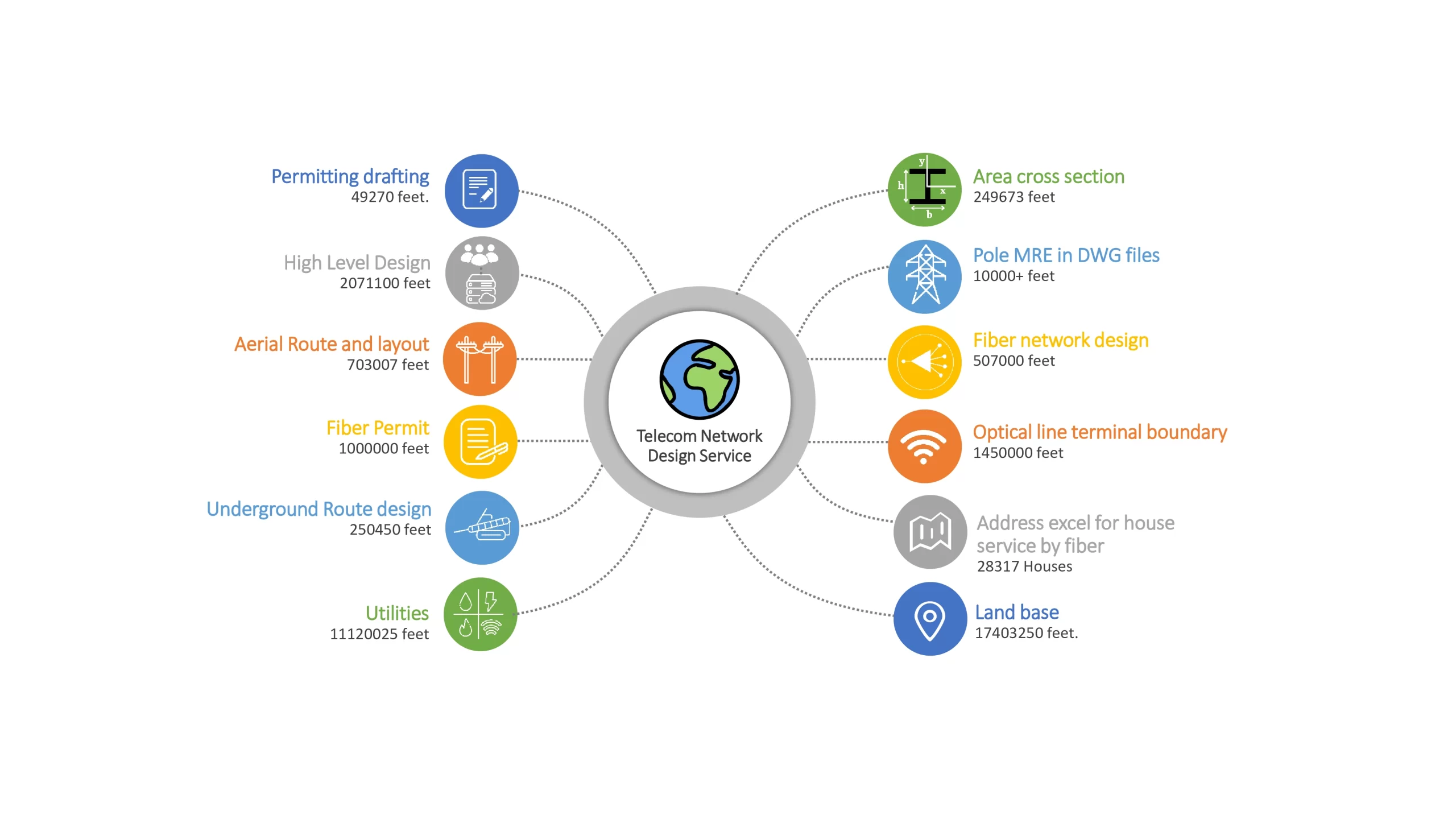
Sudarshan CADD has successfully supported several customers across the GIS Basemap design and drafting services, known as GIS Basemap Preparation, and GIS Services, with a purpose to support global Engineering, Procurement, and Construction (EPC) service providers in planning, designing, managing, and upgrading telecommunications networks. The following are our primary services for the international telecom sector:
Our GIS Basemap Network Preparation & Design Service
What We Do In FTTH Design & Mapping
FTTH Design Services
Advanced Fiber Network Design for Efficient Last-Mile Connectivity
Our expert-driven designs combine GIS intelligence, CAD precision, and telecom engineering best practices to support residential, commercial, and mixed-use fiber rollouts across urban and rural environments.
Our Design Capabilities
-
Network architecture planning (GPON / FTTx)
-
Feeder, distribution & drop fiber design
-
Splitter placement & fiber allocation
-
Pole-mounted & underground design layouts
-
BOQ, splicing schedules & loss budget calculations
-
Construction-ready CAD & GIS drawings

Fiber and Broadband
FTTx design and drafting services
Preliminary Network Design & Planning
Low Level Design (LLD)
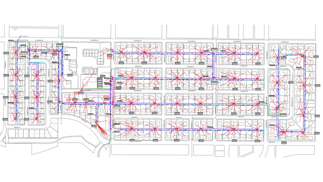
GIS-Based Network Mapping & Data Management
High Level Design (HLD)
FTTx / Fiber Cable Routing
BOQ & BOM Preparation

OPS Design Services
Scalable, Faster & Future-Proof Fiber Infrastructure
Our Design Capabilities
-
Route surveys & feasibility analysis
-
Aerial, underground & hybrid fiber design
-
Duct, trench & pole-line layouts
-
Fiber cable routing & capacity planning
-
Splice diagrams, fiber schematics & as-built drawings
-
Permit & ROW-aligned design documentation
Permitting
Identification of Complex & Non- Complex, Blanket Permits
ROW & Land base feature Integration
Location Map / Layout
Preparation of Permit Drawings
Documentation as per the permitting authority standards
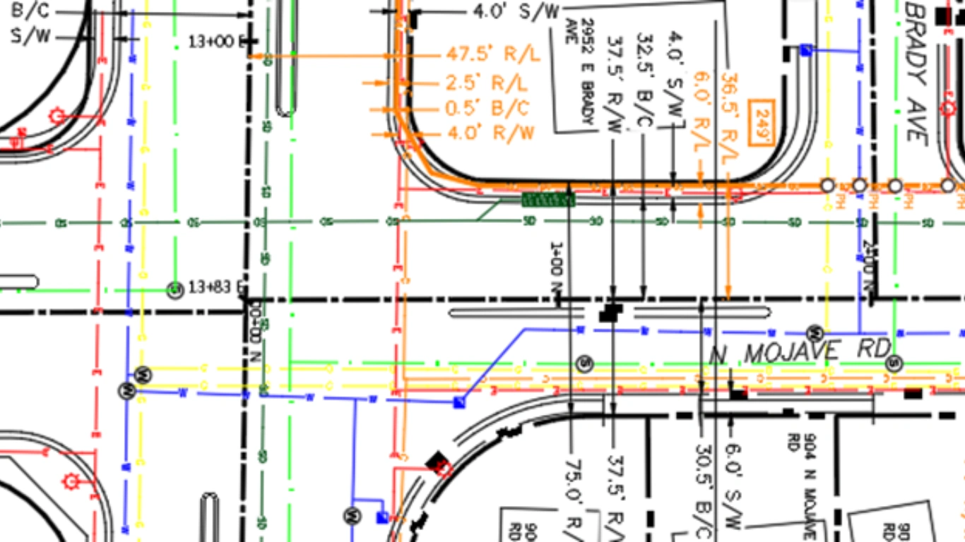
Construction Package

Construction Drawings (Plan & Profile Sheets)
Single Line Diagrams (SLD)
Fiber Route Maps & Alignment Sheets
Splice Diagrams & Splice Sheets
Bill of Quantities (BOQ) & Bill of Materials (BOM)
Aerial & Underground Network Identification
Cross-Section & Trench Detail Drawings
Traffic Control Plans (TCP) / Work Zone Layouts
Permit & Right-of-Way Drawings
GIS Land Base
Building Footprint Digitization
Road & Street Network Digitization
Parcel / Cadastre Mapping
Points of Interest (POI) Capture
Utility Corridor & ROW Mapping
Unique ID Assignment & Topology Checks
QA/QC & Data Standardization
How Does GIS Basemap Work?
Our team oversees the entire process from start to finish. During the planning stage, we evaluate multiple considerations. Using Geographic Information Systems (GIS) guarantees precise outcomes. Conventional obstacles have no impact.

High Level Design
Basemapping
Utility Drafting
Low Level Design
Aerial and UG Route design and Backbone path Design
Packaging work
Pre-permit work
Cross-Section
Critical Crossing
Prelim and Final fiber work
Ocalc
MRE
Traffic Control Plan
Streamlines permit and regulatory compliance processes.
Fast turnaround of your GIS projects
First Time Right permitting drawings
Accurate GIS documentation
Reduce cost of spatial data analysis