Tracks assets with real-time geolocation data.
Asset Management using GIS is the practice of managing physical assets—such as roads, utilities, pipelines, buildings, and equipment—through geographic data and spatial analysis. By combining traditional asset tracking with Geographic Information Systems (GIS), organizations can not only maintain detailed records of asset condition and location but also visualize these assets on interactive maps. This spatial approach enhances planning, improves maintenance workflows, supports real-time monitoring, and enables more informed, location-based decision-making across departments.
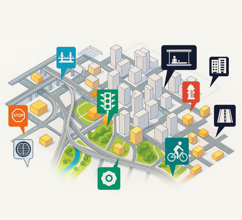
Applications of GIS in Asset Management:
Utility Management
GIS is widely used in water, gas, and electrical utilities to manage infrastructure such as pipelines, transformers, and substations.
Transportation Networks
Railways, highways, and airports benefit from GIS for managing assets like tracks, terminals, and signage.
Public Infrastructure
Municipalities use GIS to track and maintain roads, bridges, streetlights, and other public assets.
Core GIS-Based Asset Management Services
At Sudarshan CADD Tech Pvt. we offer end-to-end Asset Management solutions integrated with Geographic Information Systems (GIS) to help you effectively manage, track, and optimize the lifecycle of your physical assets — from infrastructure and utilities to equipment and land parcels.
Asset Data Collection & Digitization
High-accuracy field data capture using GPS, mobile apps, and drone imagery
Scanning, surveying, and converting legacy asset data into GIS-ready formats
Web-Based GIS Dashboard
Custom GIS dashboards for real-time monitoring of asset health and location
Integration with SCADA, ERP, or asset inventory systems
Regulatory & Compliance Mapping
Ensure compliance with zoning, utility rights-of-way, and safety regulations
Automate permit documentation and reporting through GIS tools
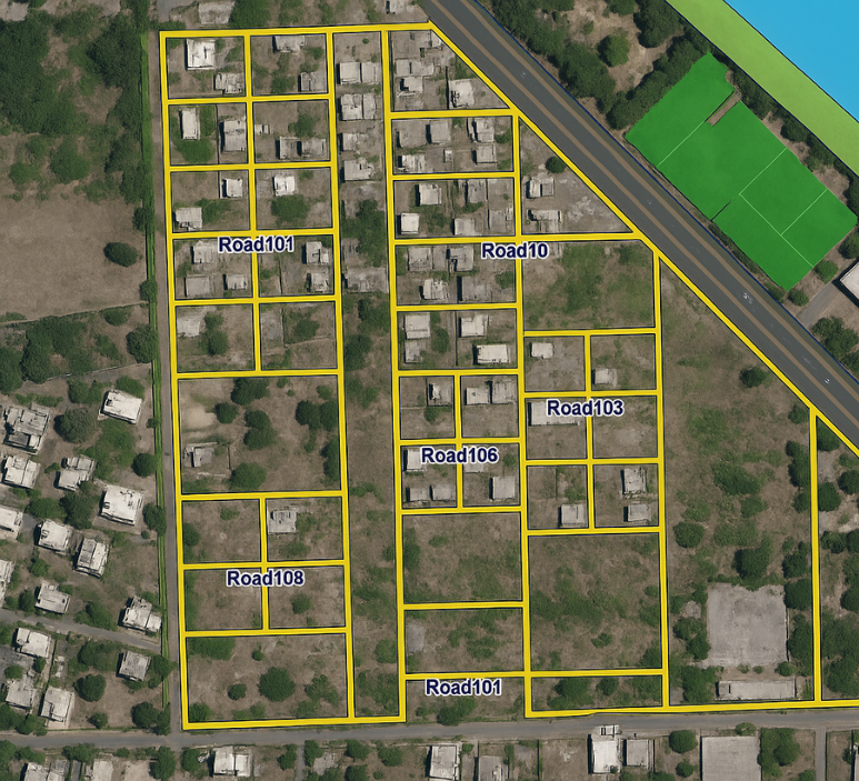
Geospatial Asset Mapping
Spatial mapping of all physical assets (utilities, pipelines, streetlights, telecom poles, etc.)
Creation of intuitive, layered GIS maps with asset metadata
Condition Assessment & Risk Analysis
Analyze deterioration patterns based on geographic and environmental factors
Perform spatial risk modeling for infrastructure prioritization
Integration with IoT & Sensors
Real-time tracking of smart assets via sensor integration
Real-time tracking of smart assets via sensor integration
Asset Lifecycle Management
Track asset installation, usage, maintenance, and replacement history
Schedule preventive maintenance using geospatial data
Work Order & Maintenance Management
GIS-integrated task allocation, inspection routes, and work order generation
mart alerts for overdue maintenance or asset downtime
Customized GIS Application Development
Mobile and desktop apps for field crews and supervisors
Role-based access and asset filtering options
Key Benefits of GIS for Asset Management:
Improves lifecycle management of physical assets.
Incorporating GIS into your asset management system allows for better visibility, improved operational efficiencies, and reduced costs. It supports a proactive approach to asset management and provides a more comprehensive solution than traditional methods.
FAQ
How does GIS improve asset lifecycle management?
GIS tracks the condition, usage, and history of assets over time. It supports proactive maintenance, helps predict failures, and assists in planning for replacements, upgrades, or decommissioning—maximizing asset lifespan and ROI.
an GIS asset management be used in real-time?
Yes. With the integration of IoT devices and mobile GIS apps, field crews and managers can view and update asset information in real-time, enhancing responsiveness and decision-making.
Is GIS suitable for small organizations or municipalities?
Absolutely. GIS solutions can be scaled to fit the needs and budgets of small towns, utilities, or companies. Cloud-based and open-source GIS platforms make it affordable and easy to implement.
How accurate is the location data in GIS asset management?
GIS can offer high levels of accuracy depending on the data source. Modern technologies like GPS, LiDAR, and drone mapping help achieve centimeter-level precision for critical infrastructure mapping.
Who benefits the most from GIS-based asset management?
Municipal corporations
Utility providers (water, electricity, telecom)
Transportation agencies
Facilities and campus managers
Oil & gas, mining, and construction companies
Environmental and forestry departments
Transportation agencies
Facilities and campus managers
Oil & gas, mining, and construction companies
Environmental and forestry departments